Eye Line competition 2013 - Commended
Janinder Bhatti, DipArch
Bartlett School
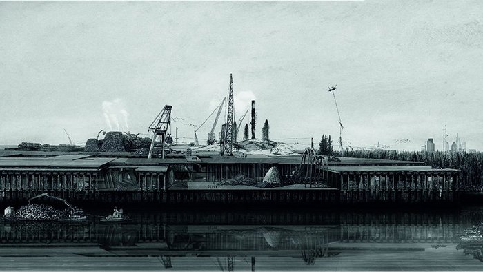
Manhattan Island Bluebelt
The subversion of Ordnance Survey representation, and what seems the complete reversal of land and water evidenced in the main plan views, were intriguing
In the context of climate change, there’s a lot of thinking going on about how the world will deal with rising sea levels, but Part II graduate Janinder Bhatti brings to this debate a fantastical methodology for its representation. Produced for her Diploma year project at London’s Bartlett School, Bhatti’s ‘Manhattan Island Bluebelt’ imagines the scenarios created from the ebb and flow of these rising global tides. Sagoo was particularly enamoured with the technique of mixing hand drawing with digital rendering, which he felt was shown here. ‘I’m interested in how students are creating digital drawings that look hand-drawn,’ he said. ‘You have to look at them twice and zoom in to see what they are.’ It’s not the only thing you have to look twice at. The judges were intrigued both with the subversion of Ordnance Survey representation, and what seems the complete reversal of land and water evidenced in the main plan views. What is the blue in these images – walkways? Is the grey water? If not, then what? The subtle red herrings set up in the images gave the work a murky resonance.